Stanley Park Bike Tour
Route Guide

Stanley Park Bike Path Map

Stanley Park's bike path traces a 9-kilometer waterfront loop that circles the entire peninsula, weaving through coastal forest and urban shoreline. The route connects rental hubs near Coal Harbour, passes iconic landmarks, and returns riders to the starting point without retracing any segment. This guide maps the complete circuit with turn-by-turn orientation and distance markers.

10 min read Updated 2026-08-19 Fact-checked
Stanley Park Bike Path Map

Quick answer

The stanley park bike path map covers a continuous 9-kilometer Seawall loop beginning at the Coal Harbour entrance near Georgia Street. The counterclockwise route passes Brockton Point, Third Beach, and Prospect Point before returning along the inner harbor. All paths are paved, clearly marked with directional signage, and separated from pedestrian lanes for the majority of the circuit.

The Seawall loop is the only bike path in Vancouver where cyclists complete a full peninsula circuit without encountering a single traffic signal. The route was carved incrementally between 1917 and 1980, with the final northern segment connecting Prospect Point to Third Beach completed in the latter year. Today it carries more than two million cyclists annually, making it one of the most heavily trafficked recreational paths in Canada. A stanley park bike path map reveals three natural segments that correspond to distinct coastal environments. The eastern shore from Coal Harbour to Brockton Point stretches 2.8 kilometers along the city-facing waterfront, where the route skirts the Vancouver Rowing Club and passes the Nine O'Clock Gun. The northern arc from Brockton Point to Third Beach covers 3.1 kilometers of exposed coastline with views across Burrard Inlet toward the North Shore mountains. The western and southern return leg runs 3.1 kilometers through sheltered forest and along English Bay, rejoining the Coal Harbour trailhead near the tennis courts. The path operates as a one-way counterclockwise loop for cyclists, with pedestrians assigned the inner lane and wheeled traffic holding the outer edge. Directional arrows are painted at every major junction, and kilometer markers appear at 500-meter intervals beginning at the Coal Harbour entrance. Rental stations cluster near the Georgia Street access point and at Second Beach concession, ensuring riders can pick up or return bikes without backtracking. The grade remains flat for the first 5 kilometers, then climbs 40 meters over a 1.2-kilometer stretch approaching Prospect Point before descending back to sea level. Navigating the cycling route in Stanley Park requires no specialized wayfinding skill—the Seawall itself is the only continuous paved path wide enough for two-way traffic, and every side trail is marked with distance-to-destination signage. Riders who lose orientation can reference the water: keeping the ocean on the right ensures counterclockwise travel, the designated direction for bikes. The park opens daily from 06:00 to 22:00, and the path remains lit along the southern Coal Harbour segment but unlit through the forested northern sections after dusk.

“The Seawall loop is the only bike path in Vancouver where cyclists complete a full peninsula circuit without encountering a single traffic signal.”
Itinerary

Navigating the Stanley Park Bike Path Map and Seawall Route

This route plan suits cyclists of all levels tackling the full 9 km Seawall loop counterclockwise from Coal Harbour. Expect 60–90 minutes of riding time, plus stops.

Start

Coal Harbour Entry Point

Begin at the designated bike path entrance near the Vancouver Convention Centre. Follow the counterclockwise route—mandatory for cyclists—heading west along the waterfront.

15 min

Brockton Point & Totem Poles

Pass the Nine O'Clock Gun and continue to Brockton Point, where the totem poles stand just off the path. Most riders pause briefly here for photos before continuing north.

30 min

Prospect Point Lookout

Reach the northwest corner of the park, the highest elevation on the loop. The climb is gradual; stop at the lookout for views over the Lions Gate Bridge and Burrard Inlet.

45 min

Third Beach Descent

Descend along the forested western shore toward Third Beach. The path here is shaded and slightly narrower; watch for pedestrians sharing the route.

60 min

English Bay & Sunset Beach

Complete the loop as the path curves back east through English Bay. The terrain flattens and widens; this stretch offers open water views before you return to Coal Harbour.

Timing

Best Time to Follow the Stanley Park Bike Path Map

To experience the Seawall at its quietest, follow the best arrival window of 06:00–09:00. This early timeframe allows cyclists to navigate the path before peak pedestrian and tourist traffic increases.

Spring (April-May)

Moderate

Mild 10°C to 16°C

Clearer paths and blooming gardens provide ideal cycling conditions before summer peak.

Summer (June-August)

High

Warm 18°C to 22°C

Expect heavy congestion throughout the day; early morning is essential for a smooth ride.

Autumn (September-October)

Moderate

Cool 10°C to 15°C

Lower crowd levels and stable temperatures make this a preferred time for local cyclists.

Weekday mornings

Low to moderate

Visiting between Monday and Friday before 09:00 ensures minimal congestion on the bike path.

Verdict: The best time to ride is Tuesday to Thursday, arriving between 06:00 and 09:00 during the months of April or October.

What to see

Notable Sights Along the Stanley Park Bike Path Map

The Stanley Park seawall path serves as a primary artery for exploring the park's diverse landmarks. Refer to these points of interest to track your progress along the route.

Brockton Point

Brockton Point

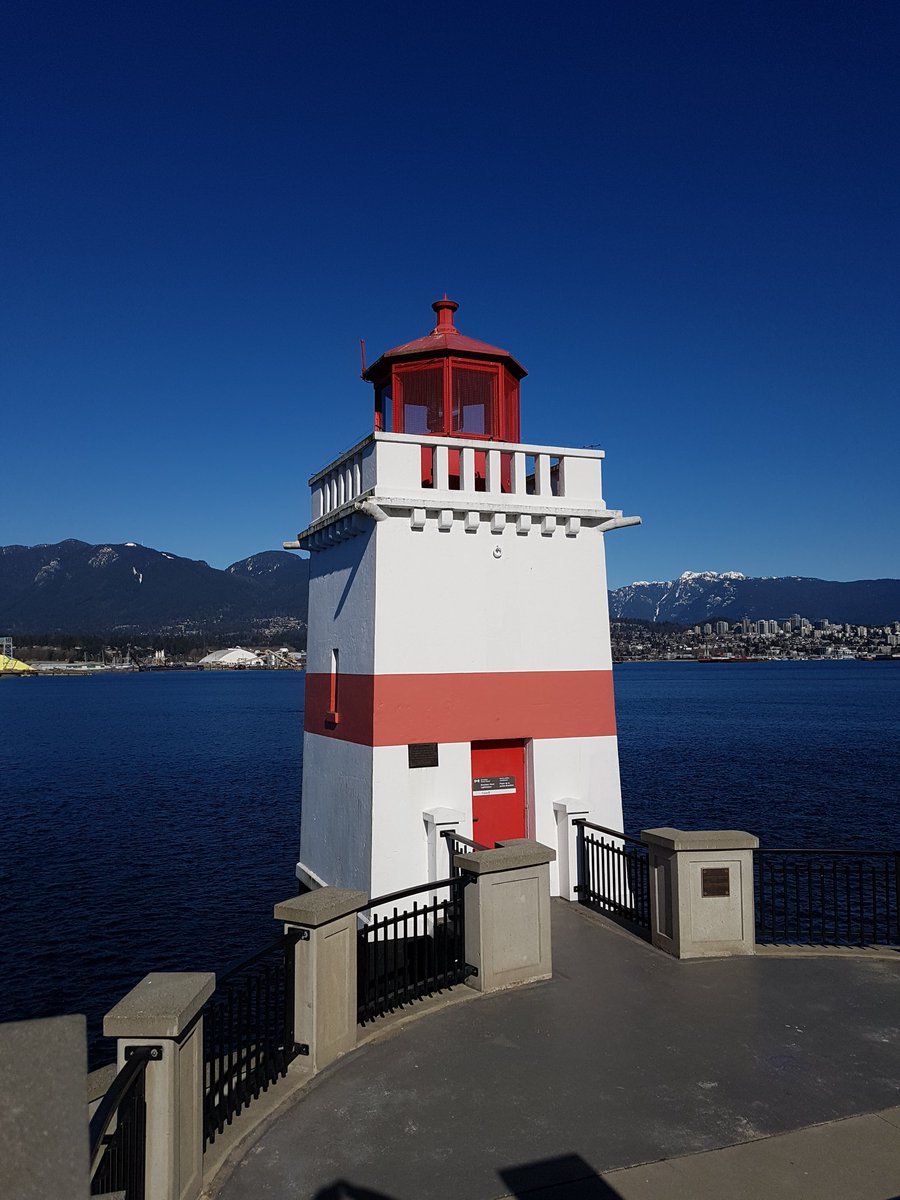
Located on the eastern side, this area features a historic lighthouse and the nearby totem poles. It provides clear views of the Burrard Inlet and the North Shore mountains.

Stop at the lighthouse to see shipping vessels passing through the inlet.
Totem Poles

Totem Poles

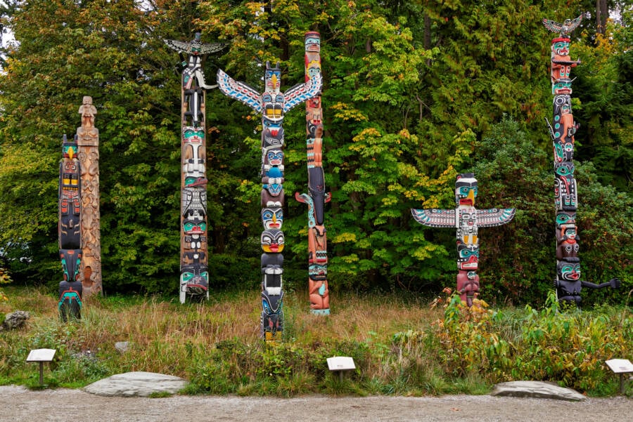
These nine carved poles represent the cultural heritage of First Nations people of the Pacific Northwest. They are situated near Brockton Point on the park's eastern side.

Walk the path behind the poles for better photography angles.

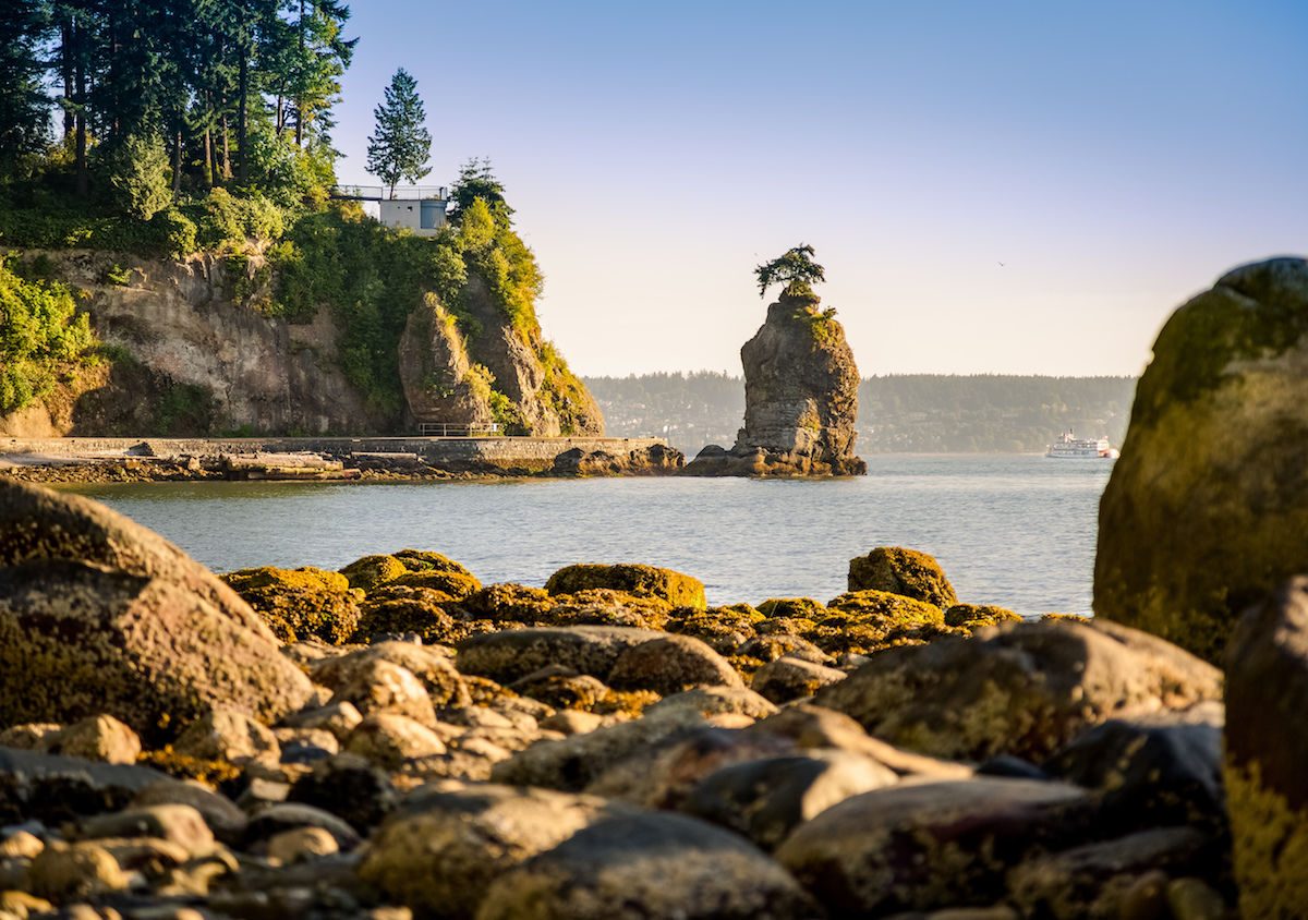
Siwash Rock

Siwash Rock

A 32-million-year-old sea stack rising from the water, this landmark is visible from the western portion of the seawall. It is a prominent geological feature of the park.

View this rock formation from the designated seawall pull-out area.

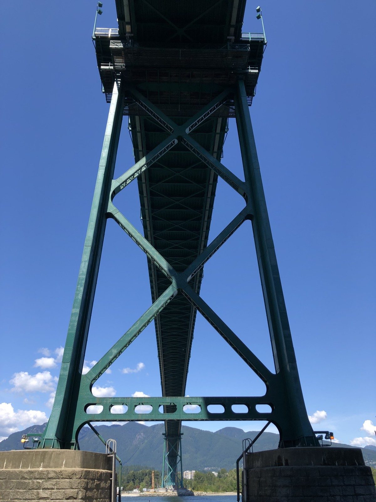
Lions Gate Bridge

Lions Gate Bridge

This suspension bridge connects Vancouver to the North Shore and spans the First Narrows of the Burrard Inlet. The path passes directly beneath its massive steel structure.

Look upward from the path for a sense of the scale.

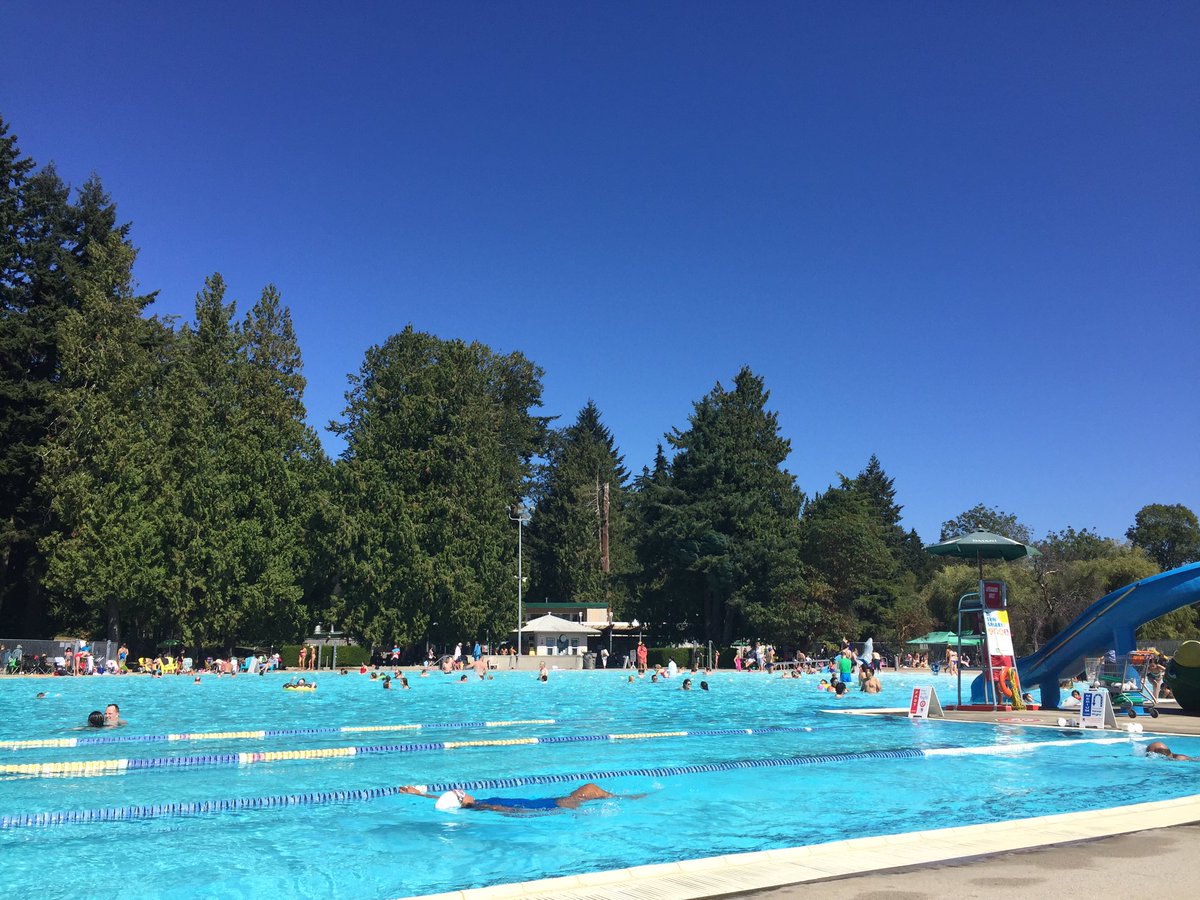
Second Beach

Second Beach

Situated on the western side of the park, this area features a heated outdoor pool and a sandy beach. It is a common place to pause during a ride.

Check the seawall edge for ocean views toward English Bay.

Directions

Arriving at the Start of the Stanley Park Bike Path Map

Stanley Park is located at the northern tip of the downtown Vancouver peninsula. The most direct approach to the Seawall bike path is via the Georgia Street entrance or the Coal Harbour waterfront.

Bus 30 min

#19 Metrotown/Stanley Park to Stanley Park Loop

Car 20 min

Georgia Street entrance via Highway 99

On foot 15 min

From Denman Street to the Seawall

For the best experience, use the arrival window of 06:00–09:00 to navigate the Seawall before peak daily crowds arrive.

Opening hours

Stanley Park Bike Path Map Operating Hours

Stanley Park is open daily to the public, including all weekends and holidays. The bike path remains accessible during these standard operational hours.

Monday
06:00–22:00
Tuesday
06:00–22:00
Wednesday
06:00–22:00
Thursday
06:00–22:00
Friday
06:00–22:00
Saturday
06:00–22:00
Sunday
06:00–22:00
Public access to the park grounds is permitted until closing time at 22:00.
Prices

Entrance Fees for the Stanley Park Bike Path Map

Access to Stanley Park and its extensive bike path network is provided at no cost. Fees only apply to specific services such as vehicle parking or equipment rentals.

Park Admission Public access is free of charge
0 CAD
Vehicle Parking Fees apply based on season and duration
Variable
Bike Rentals Third-party vendors set independent pricing
Variable
Entry to the park grounds is free for all visitors at all times.

Verdict: A typical visitor pays 0 CAD for park entry, though expenses may arise from parking requirements or optional bicycle rentals.

Etiquette

Rules for Following the Stanley Park Bike Path Map

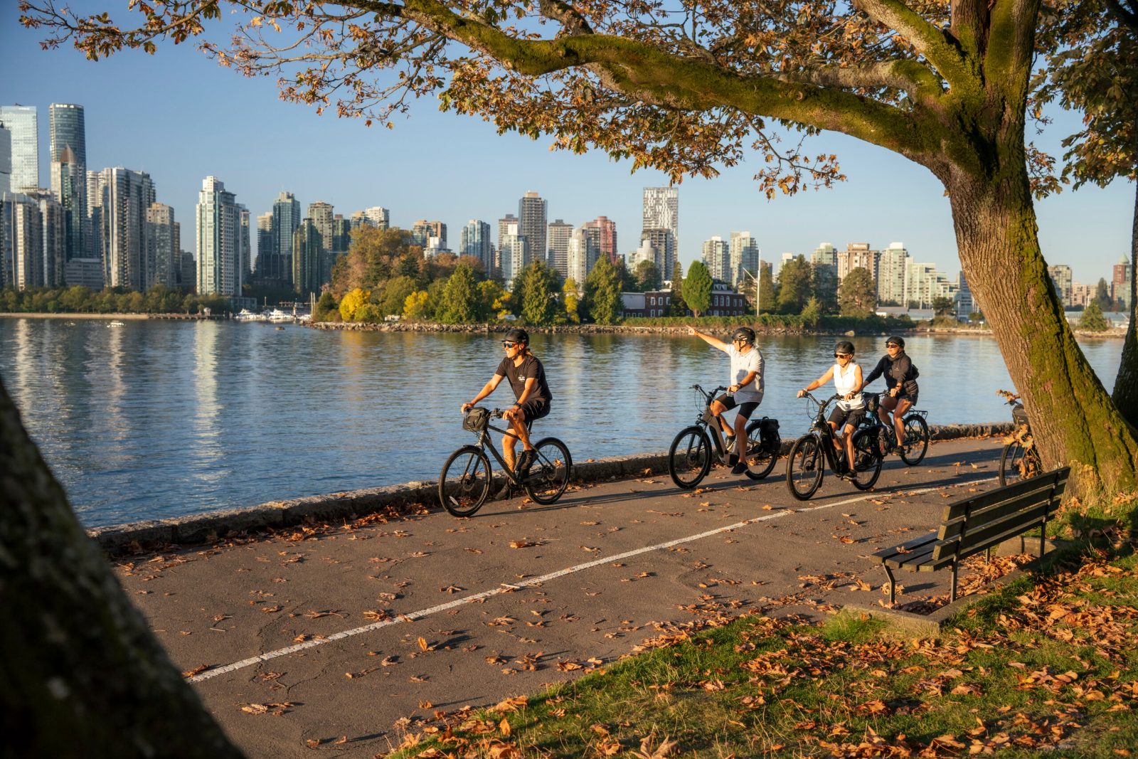
The Seawall operates as a one-way counterclockwise loop with dedicated lanes for cyclists and pedestrians. Following path etiquette keeps the route safe and flowing smoothly for everyone.

Do

  • Stay in the cycling lane and follow the counterclockwise direction
  • Keep a moderate pace and call out when passing slower cyclists
  • Yield to pedestrians at crosswalks and shared sections
  • Use a bell or voice to signal before overtaking
  • Dismount and walk your bike through crowded areas
  • Stay right within the cycling lane to allow faster riders to pass

Don't

  • Don't ride against the one-way flow or enter the pedestrian lane
  • Don't speed through congested areas near attractions and viewpoints
  • Don't pass without signaling or weave unpredictably between riders
  • Don't block the path while stopped—pull fully to the side
  • Don't ride side-by-side when other cyclists need to pass
Book

Check availability

Frequently asked

Frequently asked questions about the Stanley Park bike path map

Everything you need to know about stanley park bike path map

Where can I find a reliable stanley park bike path map?

You can find an updated stanley park bike path map on the official city website or at various signage points throughout the park. Digital versions are also available for download to help you navigate the 8.8-kilometer seawall perimeter.

Is the Vancouver seawall bike route easy to follow?

The path is well-marked and follows the coastline, making the Vancouver seawall bike route very intuitive for visitors. You will find clear signage directing cyclists and pedestrians along the paved path.

What is the best time to explore the Stanley Park cycling trails?

The best arrival window is 06:00–09:00 to avoid peak crowds and enjoy the Seawall in quieter conditions. Navigating the stanley park bike path map early in the morning ensures a smoother ride.

Are there fees to access the park with my own bicycle?

There is 0 CAD entrance fee to enter the park, meaning you can enjoy the cycling trails for free. Note that specific attractions within the park and parking facilities do have associated fees.

Can I bring children to ride on the Stanley Park loop?

The park is very family-friendly, and the flat, paved trails are suitable for most young riders. Many families use the stanley park bike path map to plan shorter, manageable routes that include playground stops along the seawall.

What should I keep in mind regarding cycling etiquette in the park?

Cyclists must stay on designated paths, yield to pedestrians, and pass on the left when safe to do so. Always remain aware of your surroundings and adhere to the posted speed limits to ensure safety for everyone.

Are there bike rentals available near the park entrance?

While we provide booking options for guided tours, several third-party rental shops operate near the main entrances of the park. These shops often provide a physical copy of a cycling trail guide with your rental.

Do I need a printed map of the Vancouver landmarks to navigate?

While a printed version of the local landmarks can be helpful, the main loop is easy to navigate by simply following the seawall signs. Most cyclists find that the provided digital resources offer sufficient guidance for a full park tour.

Keep reading

More guides & pages